 ar
ar bg
bg hr
hr cs
cs da
da nl
nl fi
fi fr
fr de
de el
el hi
hi it
it ko
ko no
no pl
pl pt
pt ro
ro ru
ru es
es sv
sv tl
tl iw
iw id
id lv
lv lt
lt sr
sr sk
sk sl
sl uk
uk vi
vi et
et hu
hu th
th tr
tr fa
fa ms
ms hy
hy ka
ka ur
ur bn
bn mn
mn ta
ta kk
kk uz
uz ku
ku
water gauge level
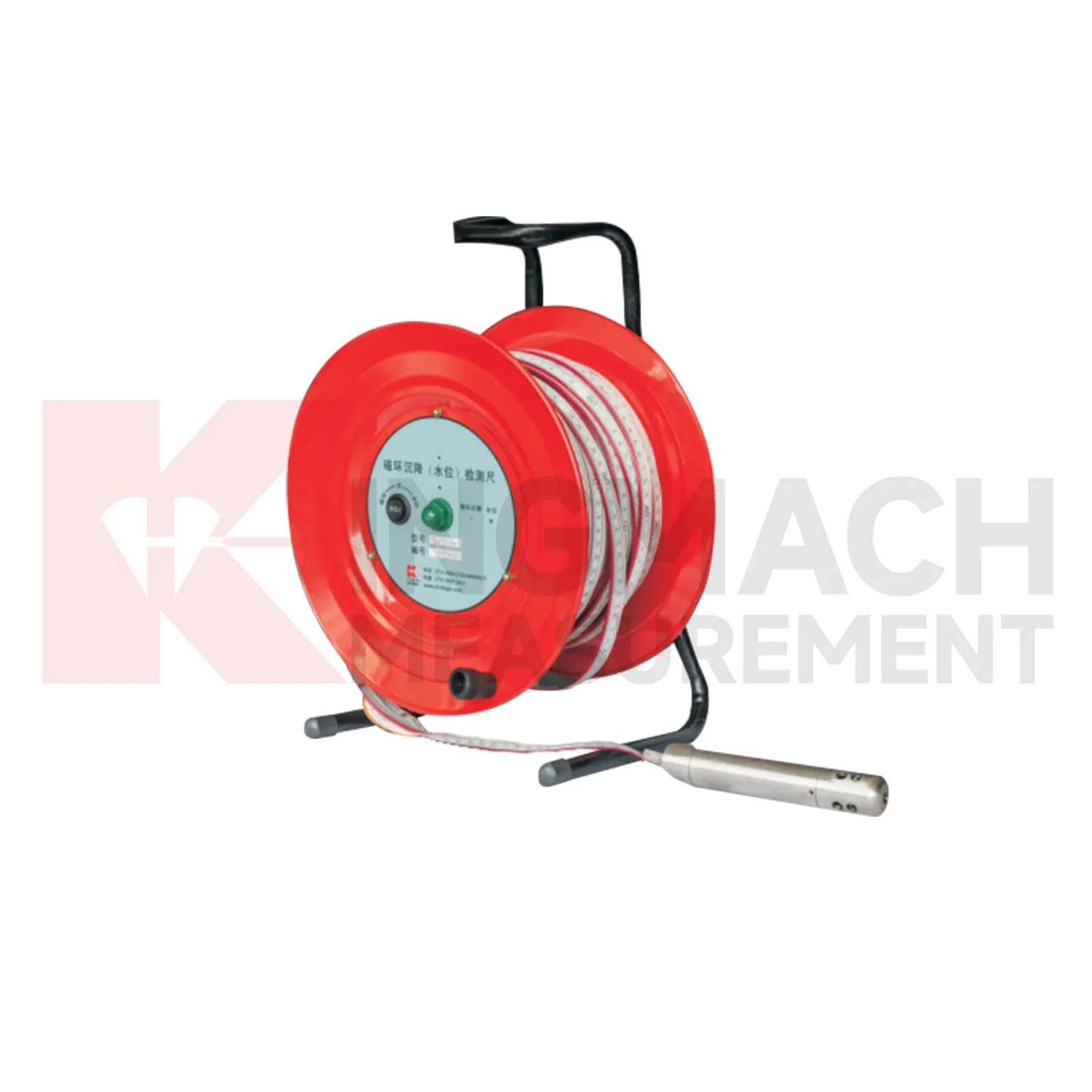
Data acquisition for Kingmach water gauge level can be arranged as manual checking, remote digital collection, or a mixed program. JMDL-47XXAT can be read by comprehensive testers or connected to automatic acquisition for remote transmission. JMDL-62XXADT, JMQJ-62XXADT, and JMYC-62XXAD provide RS485 output, which helps when several hydrostatic channels need to be read from a cabinet or platform. JMCJ-1003/1005 remains a field-reading instrument for magnetic ring depth and groundwater level confirmation. The acquisition plan should define sampling interval, channel address, unit display, reference point, abnormal-data review, and power backup. Manual readings are still useful after storms, construction impacts, cabinet faults, or unexpected curve jumps because they can confirm whether the instrument, reference, or site condition has changed. Good data handling also needs versioned baseline records, clear point names, and visible maintenance notes. Without that discipline, a long settlement curve may look complete but still be hard to trust during engineering review.
Application of water gauge level
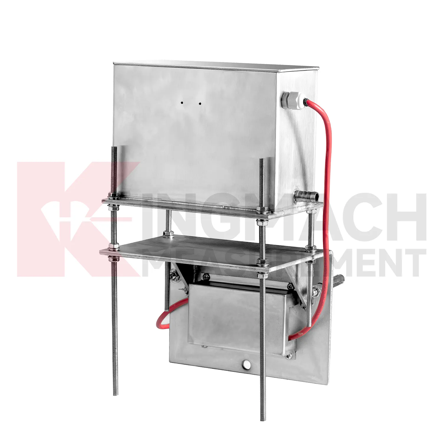
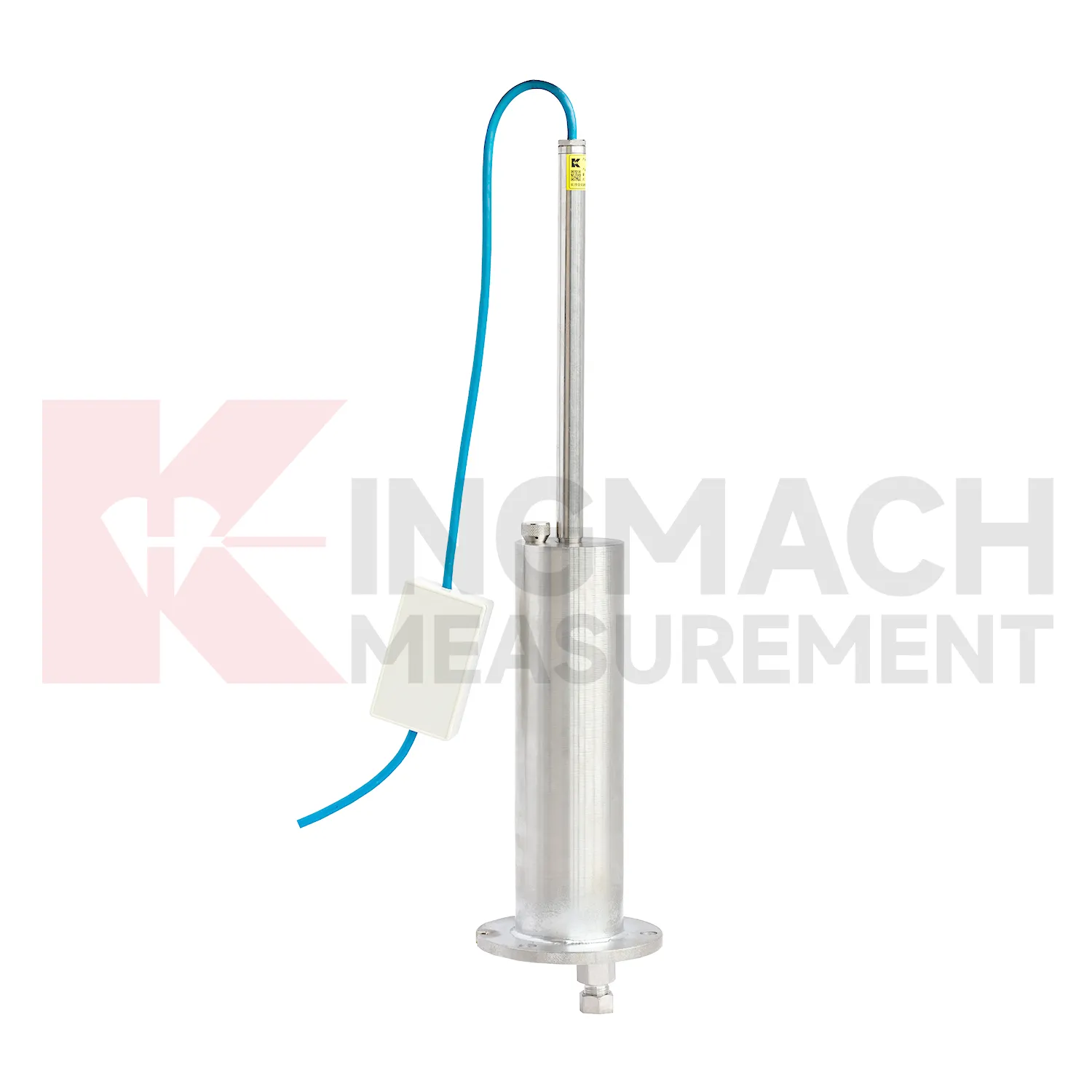
Integrated structural health monitoring uses water gauge level as the vertical deformation layer within a larger data set. Settlement rarely explains a site by itself; it usually needs to be read with tilt, strain, load, pore pressure, displacement, water level, rainfall, vibration, and inspection findings. Kingmach settlement products support several measurement styles, including embedded single-point gauges for foundations and subgrades, hydrostatic level sensors for multi-point comparison, wide-range differential pressure instruments for long profiles, and magnetic ring gauges for layered soil observation. Before installation, each point should have a reason: a pier bearing seat, a soft ground section, a basement wall, a tunnel invert, or a dam gallery position. The alarm logic should then match that reason, not just a generic number. For example, a slow uniform drift across all hydrostatic channels may mean something different from one local point moving against a steady reference. A well organized system keeps channel names, drawings, baselines, thresholds, and inspection duties connected so the team can act on the signal instead of debating where it came from.
The future of water gauge level
Future water gauge level reports will need to be clearer for both engineers and owners. A useful settlement report should show baseline date, latest value, cumulative settlement, rate of change, reference point status, water level condition, construction stage, and recommended inspection action. It should also include whether the reading was manual, remote, magnetic ring based, hydrostatic, or embedded single-point measurement. Kingmach products generate different kinds of settlement information, so reporting should preserve that context instead of flattening every value into one table. For high-risk projects, trend graphs should sit beside field notes and photos. That makes it easier to decide whether a movement is normal consolidation, reference disturbance, water-related change, or a condition that needs immediate review. The practical goal is to keep settlement data understandable after the original installation crew has left, so owners can compare old and new readings without reconstructing the field history from memory. The same record should remain readable for designers, contractors, owners, and maintenance teams, because settlement monitoring often continues long after the first construction report is finished.
Care & Maintenance of water gauge level
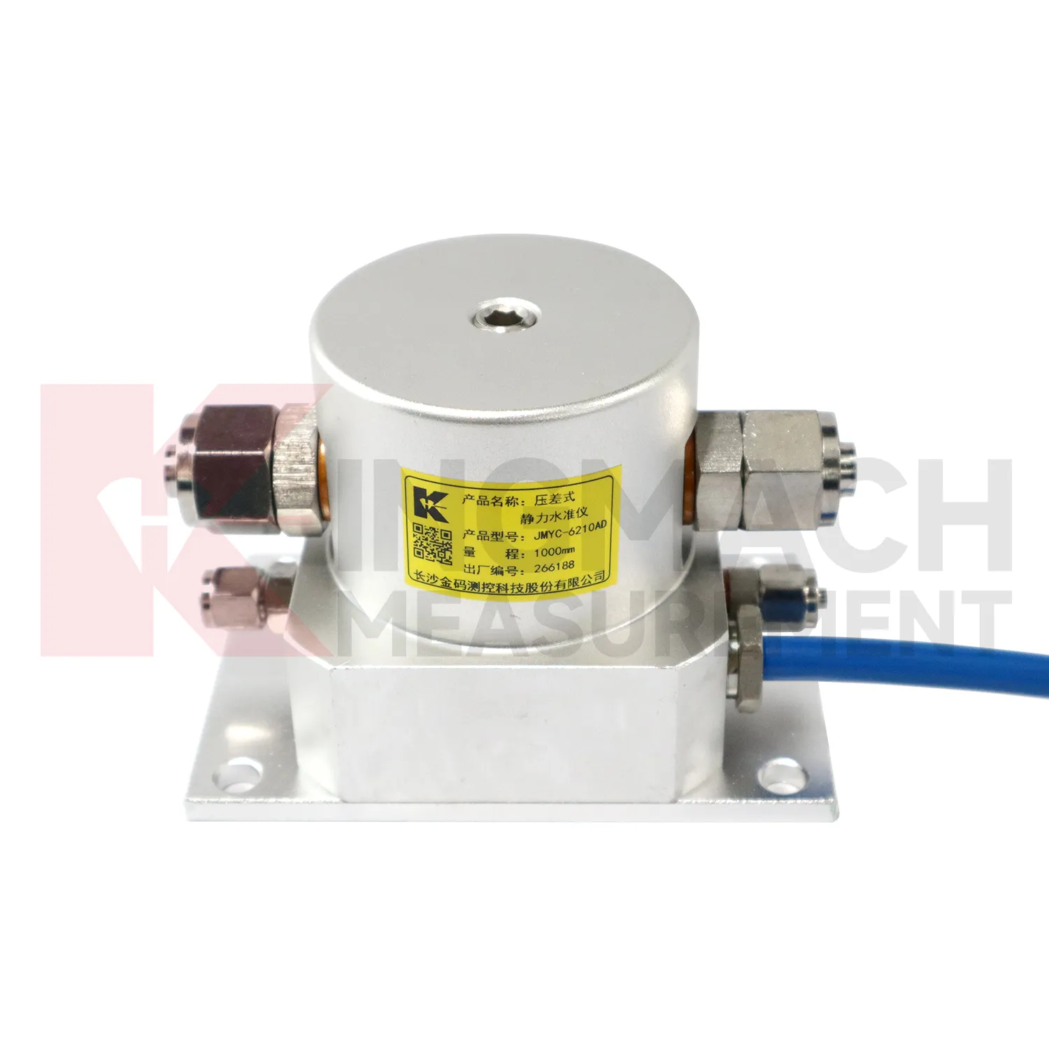
Care and maintenance of water gauge level should begin before the first sensor is installed. Confirm whether the location needs an embedded single-point gauge, a hydrostatic leveling sensor, a wide-range differential pressure system, or a magnetic ring settlement water level gauge. Kingmach JMDL-47XXAT covers 100 mm to 400 mm embedded ranges, while JMYC-62XXAD covers larger 500 mm to 4000 mm hydrostatic ranges. Choosing the wrong range can shorten the useful life of the point or hide small early movement. The project file should record model, range, structure name, point elevation, expected movement direction, reference point, cable or tube route, and first stable value. During later checks, compare actual movement with the construction stage and nearby instruments. If a value approaches the end of travel, plan verification before the sensor saturates. Range management is maintenance because it protects the continuity of the settlement record.
Kingmach water gauge level
water gauge level are not only construction instruments; they also support long-term asset management. A bridge, dam, subway, railway, building, or embankment can continue moving slowly after the main construction phase is complete. Kingmach settlement products can help owners compare early baseline readings with later operation-stage data. The important question is whether movement has stopped, slowed, restarted, or changed after water level, traffic load, rainfall, excavation, or repair work. A clean settlement record should include cumulative value, daily or monthly rate, reference condition, sensor status, and inspection notes. When the same point is reviewed for years, small changes become easier to interpret. Without that record, later teams may waste time rediscovering what the original installers already knew. Over time, this disciplined record helps owners separate normal consolidation from renewed settlement caused by water, load, excavation, or long-term material behavior. Over time, this disciplined record helps owners separate normal consolidation from renewed settlement caused by water, load, excavation, or long-term material behavior.
FAQ
Q: How should water gauge level be maintained?
A: Check reference points, tubes, cables, seals, settlement plates, anchors, probes, cabinets, and channel names at planned intervals.
Q: Should zero values be reset casually?
A: No. A reset can hide real settlement. If a reset is necessary, record the reason, time, old baseline, and new baseline.
Q: What data should be reviewed with settlement?
A: Rainfall, groundwater, excavation depth, filling stage, traffic loading, tilt, displacement, strain, and load data can all help explain settlement changes.
Q: What signs suggest a data issue?
A: Flat lines, sudden jumps after maintenance, impossible values, repeated communication gaps, or disagreement with nearby points may indicate instrument or data-chain problems.
Q: What makes a settlement report useful?
A: A useful report includes point location, model, range, baseline, reference point, latest reading, cumulative settlement, rate of change, and field notes.
Reviews
Daniel Brown
Excellent environmental monitoring sensors. The data is consistent, and the system integrates smoothly with our existing setup.
Joshua Clark
We ordered a full monitoring solution including sensors and data loggers. Everything works seamlessly together. Great supplier!
Latest Inquiries
To protect the privacy of our buyers, only public service email domains like Gmail, Yahoo, and MSN will be displayed. Additionally, only a limited portion of the inquiry content will be shown.
Ava***@gmail.comAustralia
Hi, I am looking for reliable tiltmeters and accelerometers for structural health monitoring. Please...
Mia***@gmail.comNetherlands
Dear team, we are interested in your readouts & data loggers compatible with multiple sensors. Do yo...
Related product categories
- water level gauge
- water gauge water level gauge
- water gauge level
- gauge water level
- Magnetic Ring Settlement Water Level Gauge
- Optical Deflection Monitor
- Tilt Sensor
- Deflectometer
- Micro Range Hydrostatic Level Sensor
- Single-point Settlement Meter
- Optical Deflection Monitor
- Inclinometer-based Hydrostatic Leveling System