 ar
ar bg
bg hr
hr cs
cs da
da nl
nl fi
fi fr
fr de
de el
el hi
hi it
it ko
ko no
no pl
pl pt
pt ro
ro ru
ru es
es sv
sv tl
tl iw
iw id
id lv
lv lt
lt sr
sr sk
sk sl
sl uk
uk vi
vi et
et hu
hu th
th tr
tr fa
fa ms
ms hy
hy ka
ka ur
ur bn
bn mn
mn ta
ta kk
kk uz
uz ku
ku
wireless tiltmeter
The JMZX-7100L sliding inclinometer is a field profiling instrument within the Kingmach wireless tiltmeter group. It is used for measuring horizontal displacement changes inside soil masses in dams, building foundations, embankment slopes, underground construction projects, geotechnical slopes, and port engineering. The instrument combines a sliding inclinometer probe with a 3D-MEMS silicon capacitor biaxial inclinometer sensor and an integrated testing instrument. It supports mobile phone APP reading, Bluetooth transmission, large storage capacity for millions of readings, data download for numerical and graphical analysis, real-time wireless network sending, Chinese and English menus, and dedicated post-processing software. Published specifications include +/-90 degrees sensor range, 500 mm guide wheel spacing reference, a probe size of 26 mm by 776 mm, 8.5 kg total weight, 2 kg probe weight, -20 degrees Celsius to +60 degrees Celsius operation, 180 m water pressure impermeability, and 100 g vibration resistance.
Application of wireless tiltmeter
Port and underground construction projects use wireless tiltmeter to follow soil movement, retaining structures, and deep displacement where surface survey alone is limited. JMZX-7100L is described for port engineering and underground construction projects, with Bluetooth communication, APP reading, large storage, and post-processing software. The sliding probe method is useful when engineers need a deformation profile along an inclinometer casing rather than one fixed surface angle. Field crews should keep casing ID, depth interval, probe orientation, reading direction, groundwater condition, and operator notes consistent. Data can then be compared with excavation, dredging, surcharge loading, pile work, or retaining wall movement. Good field discipline prevents a profile change from being confused with probe handling differences.
The future of wireless tiltmeter
Data interpretation will become a stronger part of future wireless tiltmeter use. Angle values are precise, but the engineering meaning depends on direction, rate, location, structure type, and nearby events. A building column tilt record, a slope borehole profile, and a bridge pier rotation curve should not be judged the same way. Future platforms can help by grouping points by structure, showing rate of change, linking photos and inspection notes, and comparing tilt with settlement, displacement, strain, load, and water level. Kingmach tilt products provide the sensing layer; the next practical gain comes from making review workflows clearer. Better interpretation reduces both missed warnings and unnecessary field alarms.
Care & Maintenance of wireless tiltmeter
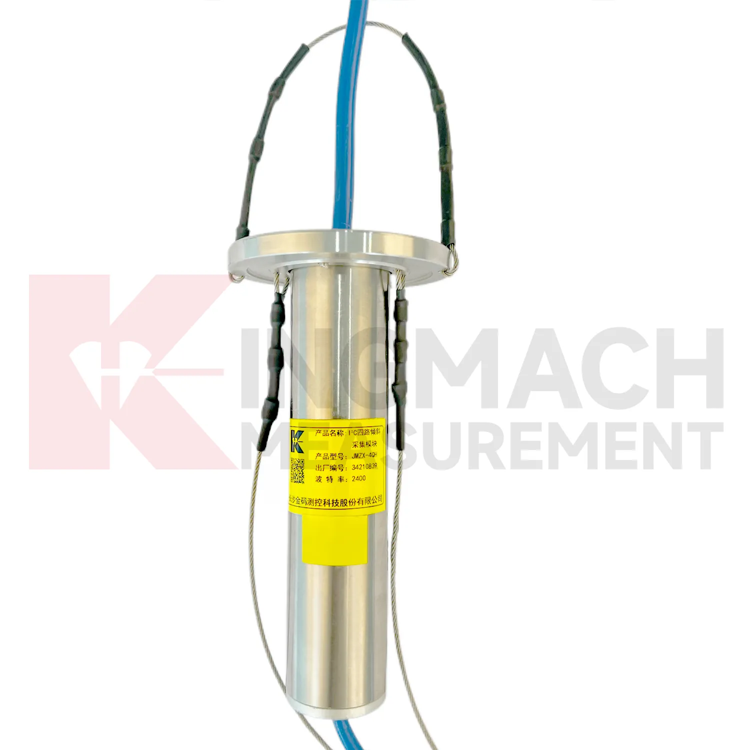
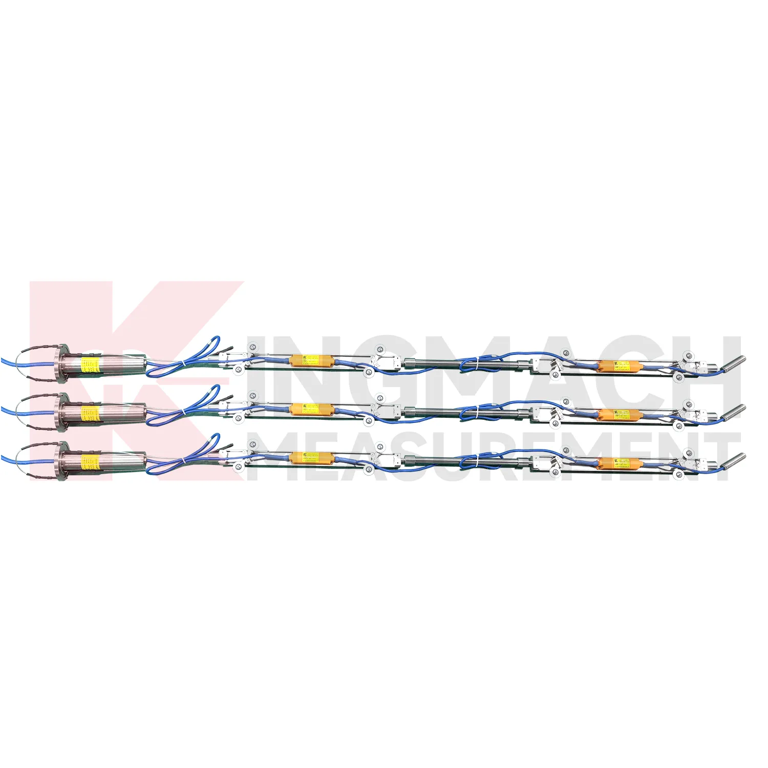
Borehole systems for wireless tiltmeter need careful mechanical and data maintenance. JMQJ-7915ATS uses a multi-point tandem inclinometer string with universal joints, connecting rods, suspension, cables, and an orifice acquisition module. During installation, record measurement spacing, borehole ID, casing condition, orientation, group assignment, and factory configuration. During inspection, protect the orifice, check cable strain, review module status, and compare depth points for abnormal jumps. If one depth changes sharply while neighboring depths remain steady, inspect both the ground condition and the instrument chain. Borehole data is most useful when every depth point remains tied to a clear physical position and a stable orientation reference.
Kingmach wireless tiltmeter
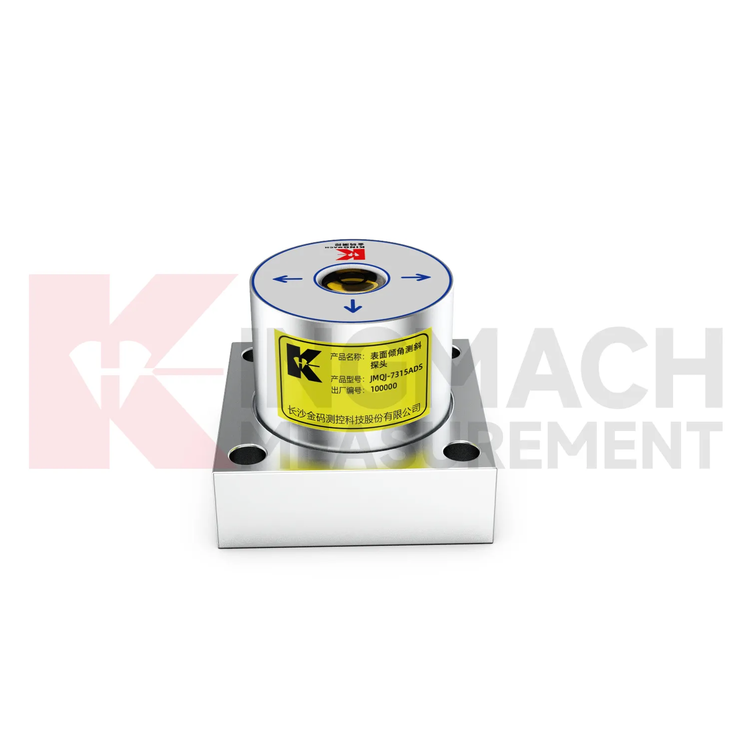
Kingmach wireless tiltmeter help engineers measure angular change in structures and ground where visual inspection cannot show early deformation. A small tilt in a bridge pier, retaining wall, building column, railway structure, or slope borehole can indicate load change, foundation movement, lateral soil pressure, or hidden internal displacement. Kingmach products use MEMS sensing, digital communication, sealed housings, and automated acquisition paths to support long-term monitoring. Fixed sensors such as JMQJ-7315ADS can measure biaxial tilt relative to the horizontal plane, while vertical in-place inclinometer systems observe multi-point deformation inside boreholes. The value of tilt monitoring is not only the angle value; it is the way repeated readings show rate, direction, and timing. When the baseline, location, axis direction, and structural event are recorded clearly, tilt data becomes a practical warning layer for civil works.
FAQ
Q: How often should wireless tiltmeter be inspected?
A: Inspection frequency depends on risk, access, construction stage, and deformation speed; active excavation or storm periods often need closer review.Q: What maintenance is needed for wireless tilt units?
A: Check battery status, antenna condition, upload timing, enclosure seals, point label, and platform channel naming.Q: What causes false tilt changes?
A: Loose mounting, disturbed cables, water entry, temperature effects, power faults, channel mistakes, or inconsistent manual reading can affect the record.Q: How should replacement be handled?
A: Record old and new model, serial number, range, baseline, reason, date, axis direction, channel name, and first stable value after replacement.Q: What makes tilt data useful over many years?
A: Consistent point naming, stable baselines, clear installation photos, protected hardware, visible maintenance records, and comparison with related site data.
Reviews
Joshua Clark
We ordered a full monitoring solution including sensors and data loggers. Everything works seamlessly together. Great supplier!
James Thompson
The tiltmeters and accelerometers are very sensitive and provide precise data. Perfect for our structural health monitoring system.
Latest Inquiries
To protect the privacy of our buyers, only public service email domains like Gmail, Yahoo, and MSN will be displayed. Additionally, only a limited portion of the inquiry content will be shown.
Olivia***@gmail.comUnited States
Hello, we are currently sourcing high-precision strain gauges and load cells for a bridge monitoring...
Isabella***@gmail.comGermany
Hello, we are evaluating weir flow meters for a water management project. Please share accuracy deta...