 ar
ar bg
bg hr
hr cs
cs da
da nl
nl fi
fi fr
fr de
de el
el hi
hi it
it ko
ko no
no pl
pl pt
pt ro
ro ru
ru es
es sv
sv tl
tl iw
iw id
id lv
lv lt
lt sr
sr sk
sk sl
sl uk
uk vi
vi et
et hu
hu th
th tr
tr fa
fa ms
ms hy
hy ka
ka ur
ur bn
bn mn
mn ta
ta kk
kk uz
uz ku
ku
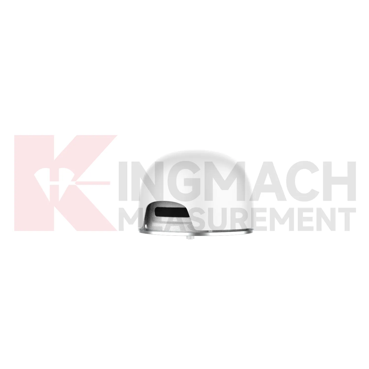
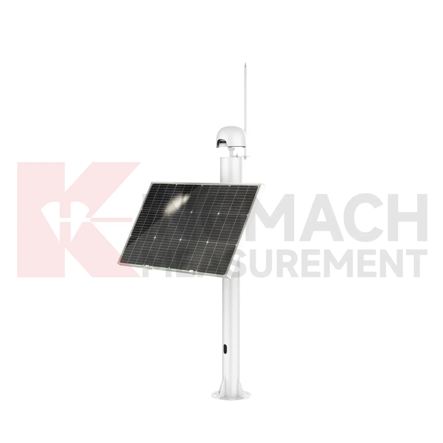
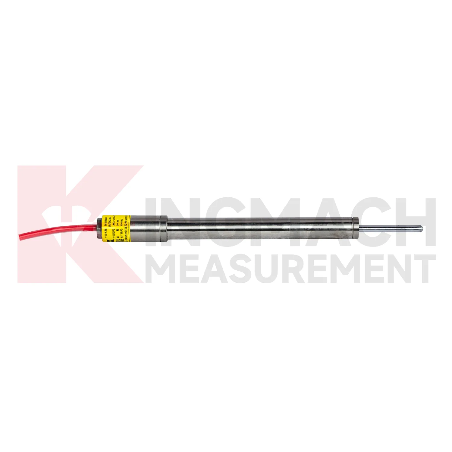
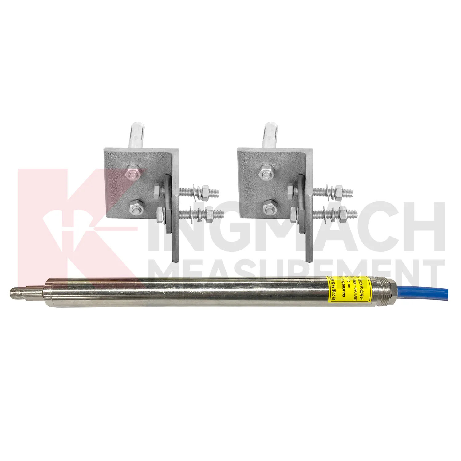
Integrated GNSS
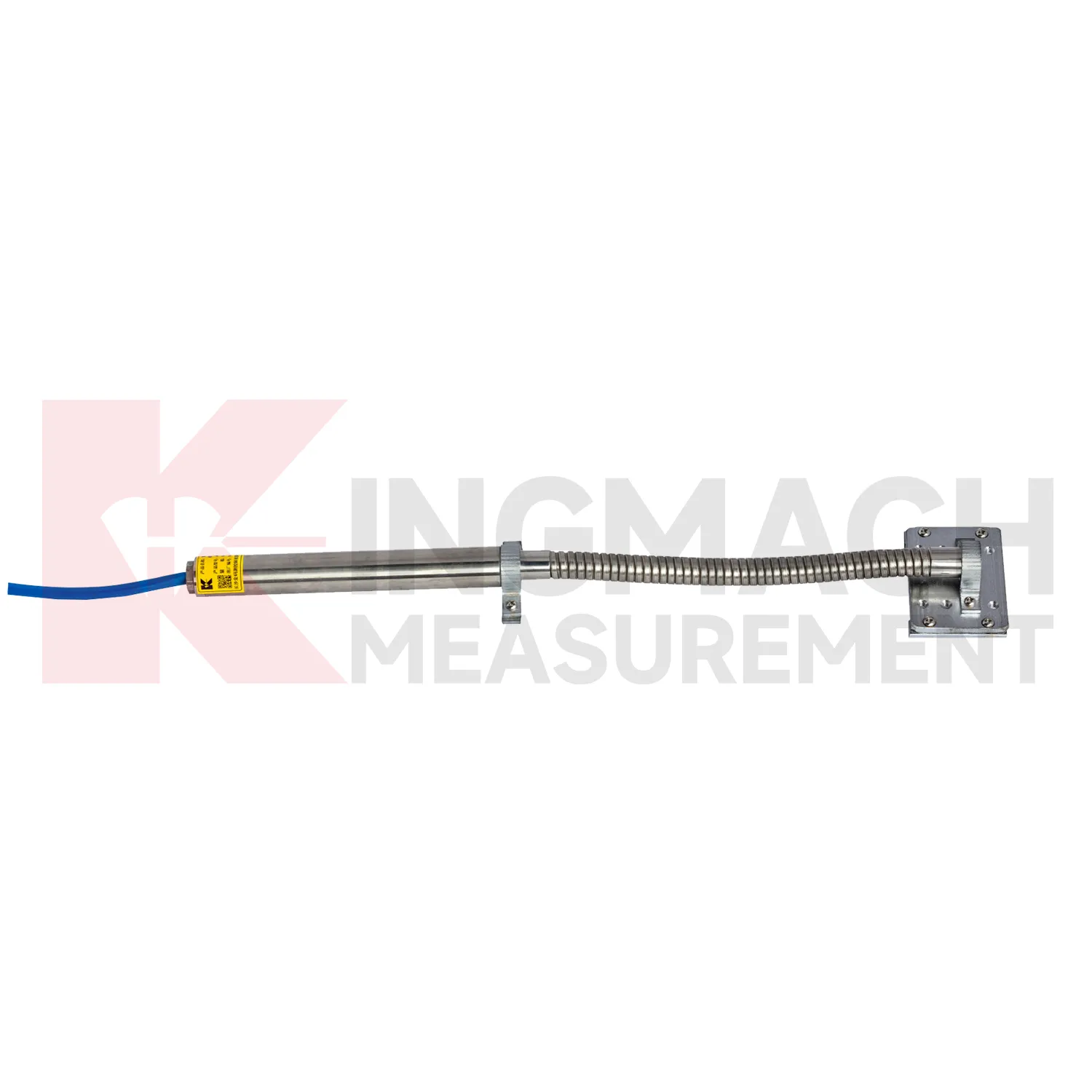
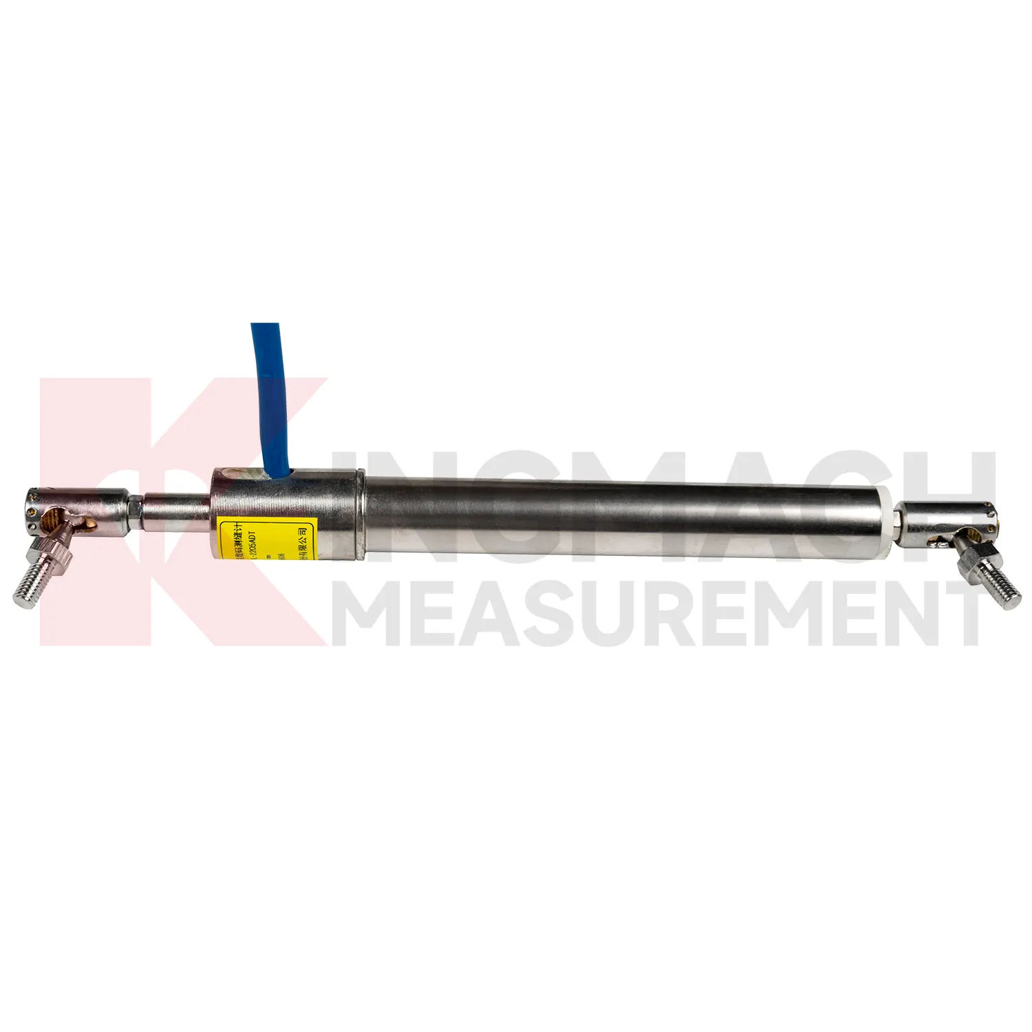
Kingmach Integrated GNSS include the JMCW-21XXADT Magnetostrictive Displacement Meter for absolute linear position measurement. This sensor uses magnetostrictive effect and internal non-contact sensing, which avoids mechanical wear and supports continuous operation in harsh environments. Product information lists 0 to 1000 mm measuring range, 0.01 mm resolution, plus or minus 0.05%FS accuracy, repeatability within 0.1 mm, DC24V plus or minus 10% input, RS485 communication, average operating current below 60 mA, and an operating temperature range from -30 degrees Celsius to +80 degrees Celsius. It also lists IP67 protection and reverse polarity protection up to -36V. Wiring details include red for DC24V, yellow for power ground, blue for RS485A, and green for RS485B. These features make the product suitable for hydraulic cylinders, gate position, machine stroke, structural deformation, railway and highway movement, retaining walls, and industrial automation equipment that requires stable absolute position data. During project setup, the measuring point should be matched with the expected travel direction, available mounting space, cable route, and required acquisition interval. This prevents a short-range joint instrument from being used on a long-travel point, or an exposed sensor from being placed where an embedded anchor is needed. It also helps the monitoring team set a baseline that can be defended during acceptance and later maintenance review.
Application of Integrated GNSS
In building and high-formwork construction, Integrated GNSS are used less like long-term bridge instruments and more like real-time construction controls. During concrete pouring, steel pipe supports, scaffold frames, formwork platforms, and temporary load paths can move quickly while workers and pumps are still operating. Kingmach JMDL-49XXAT formwork displacement meters are built for this kind of site, with 50 mm, 100 mm, and 200 mm ranges, 0.01 mm sensitivity, 0.5%FS accuracy, IP68 protection, and a listed temperature range from -40 degrees Celsius to +100 degrees Celsius. Built-in memory can store time, temperature, displacement values, and other records. On a high-formwork job, the sensor position should be tied to the pouring sequence, support layout, concrete volume, and warning action. A sudden lateral movement of a steel pipe has a different meaning from slow settlement after loading. JMDL-22XXAT crack gauges may also be used after construction to follow building joint or crack width changes. The practical value is fast site feedback while the work can still be adjusted. Site teams should define who receives alarms during pouring, how readings are confirmed, and when work should pause for inspection. This makes the displacement point part of the construction control process, not just a record reviewed after the risk has passed.
The future of Integrated GNSS
The future of Integrated GNSS will be shaped by connected monitoring rather than isolated field readings. Kingmach products already include digital detection, RS485 communication on selected models, built-in memory, stored calibration data, and compatibility with automatic acquisition systems. The next practical step is cleaner connection between the sensor identity, the monitoring point, and the platform curve. A displacement value should arrive with its model, serial number, range, calibration coefficient, zero value, temperature, and installation position. That will reduce channel errors and make later review faster. In bridges, tunnels, dams, slopes, and foundation pits, future systems will compare displacement with strain, load, tilt, settlement, rainfall, water level, and construction events. Warnings will depend less on a single limit and more on the pattern of movement across several related sensors. The strongest systems will still depend on careful installation, because digital tools cannot correct a loose bracket, wrong range, or poorly recorded baseline. Clear reporting will make displacement monitoring more useful for non-specialist decision makers while preserving the detail engineers need.
Care & Maintenance of Integrated GNSS
For differential Integrated GNSS, maintenance should preserve the geometry that makes high precision possible. Kingmach JMDL-52XXADT uses two coupled inductive coils to reduce environmental interference and thermal drift. The product lists 20 mm, 50 mm, and 100 mm ranges, 0.01 mm resolution, plus or minus 0.1%FS accuracy, RS485 output, low power consumption, and -40 degrees Celsius to +80 degrees Celsius operating temperature. During installation, align the measuring rod so it moves freely without side load or rubbing. Protect the device from impact at expansion joints and from water pooling around connectors. During service, compare readings across temperature cycles and confirm that movement returns as expected when the structure cools or unloads. A persistent offset may indicate structural change, bracket movement, or cable trouble. Keep yearly stability checks and calibration records with the monitoring database, not only in paper files. Keep the installation photo, point number, zero value, and expected movement direction with the commissioning record for later review. If a reading changes after maintenance work, inspect the base, anchor, cable, and cabinet before assuming the structure itself has moved.
Kingmach Integrated GNSS
Long-term projects need Integrated GNSS that can survive the same weather, vibration, cable pulling, and site handling as the structure itself. Kingmach designs several smart displacement products with built-in memory chips, digital detection, strong anti-interference capability, and direct display through compatible testers. The JMDL-22XXAT crack gauge stores up to 600 measurement results and covers 20 mm, 50 mm, 100 mm, and 200 mm models. The JMDL-21XXAT general-purpose model stores up to 800 records and can save time, temperature, absolute displacement, relative displacement, and zero-point values. These records matter during handover because the original baseline, later shifts, and abnormal readings can be checked without relying only on handwritten notes. For bridges, dams, tunnels, slopes, and buildings, that traceability helps maintenance teams judge whether a movement event is isolated, repeated, or linked with surrounding construction and environmental change. The point should be named on the drawing, linked with its cable route, and checked against the expected movement direction before the first automatic reading is accepted. For daily review, the reading should be compared with nearby points, recent weather, site operations, and any loading event that could explain the movement.
FAQ
Q: Which Integrated GNSS fit crack monitoring?
A: The JMDL-22XXAT Smart Crack Gauge is designed for cracks, joints, and expansion joints in bridges, buildings, roads, railways, dams, tunnels, and slopes.
Q: What ranges does the crack gauge list?
A: Listed models include 20 mm, 50 mm, 100 mm, and 200 mm ranges, with 0.01 mm resolution on the 20 mm to 100 mm versions and 0.05 mm on the 200 mm version.
Q: How many records can the crack gauge store?
A: Product information states that it can save up to 600 measurement results, including time, temperature for temperature versions, displacement values, and zero-point value.
Q: What installation details matter most?
A: Base stability, rod alignment, connector sealing, cable protection, and a clear zero reading matter more than a polished-looking installation.
Q: Can it be used for long-term observation?
A: Yes. The product is described for long-term monitoring, especially where crack width changes need stable and repeatable measurement.
Reviews
Andrew Lee
The visualization software is intuitive and powerful. It helps us analyze monitoring data efficiently.
Joshua Clark
We ordered a full monitoring solution including sensors and data loggers. Everything works seamlessly together. Great supplier!
Latest Inquiries
To protect the privacy of our buyers, only public service email domains like Gmail, Yahoo, and MSN will be displayed. Additionally, only a limited portion of the inquiry content will be shown.
Isabella***@gmail.comGermany
Hello, we are evaluating weir flow meters for a water management project. Please share accuracy deta...
Amelia***@gmail.comSingapore
Hello, I am looking for visualization software for monitoring system data analysis. Please let me kn...
Related product categories
- displacement sensor
- laser displacement sensor
- displacement sensors
- linear displacement sensor
- optical displacement sensor
- wireless displacement sensor
- laser displacement sensors
- non contact displacement sensor
- cable displacement sensor
- draw wire displacement sensor
- inductive displacement sensor
- lvdt displacement sensor